weather Austria Werfenweng
  • 15 day forecast

    - -
Snow info Last update on in 02h
Closed resort , opening scheduled on 07/12/2024
Snow
- cm at the top (1834m)
- cm down (902m)
Hard snow
Snowfall
6 months ago : 5 cm
6 months ago : 15 cm
6 months ago : 1 cm
Open tracks
0/-
0/9
0/6
0/1
Lifts : -/9
Snow Parks : -
Nordic ski : -
Back skiing : -
with ski info
Time / Hour

Today's Forecast

Cyril WUEST

Forecast produced by Cyril WUEST

Updated at - Next update at (local time)

expert la chaîne météo Expert’s summary

Today in Werfenweng, the weather will become more uncertain during the day.
Temperatures will vary between 4 and 10°C.
The reliability of the situation is good.
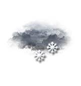
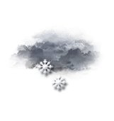
This morning


Alternating sunshine and cloud
Feels Like 3°
Gusts 5 km/h Calm
Sunny periods and passing clouds, sometimes heavy.
No precipitation.
No risk of rain
UV index 3 Moderate
Freezing level 0°
2000 m
Snow-rain limit
1700 m
Fresh snow
0 cm

This afternoon


Intermittent light rain or light showers
10° Feels Like 9°
Gusts 10 km/h Calm
Very cloudy sky turning overcast.
Light rain at the end of the afternoon.
Risk of rain 90 %
UV index 2 Low
Freezing level 0°
2000 m
Snow-rain limit
1700 m
Fresh snow
0 cm

This evening


Rain
Feels Like 6°
Gusts 10 km/h Calm
Overcast and misty. Limited visibility.
Rain.
Risk of rain 90 %
Freezing level 0°
1850 m
Snow-rain limit
1550 m
Fresh snow
0 cm

Night


Light rain
Feels Like 5°
Gusts 10 km/h Calm
Overcast and misty. Limited visibility.
Light rain clearing gradually.
Risk of rain 90 %
Freezing level 0°
1750 m
Snow-rain limit
1450 m
Fresh snow
0 cm

Ephemeris


Thursday 3 october

  • Day
    -3 min
  • Waxing
    crescent
  • Sunrise
    07h09
  • Sunset
    18h42
  • Thomas de Cantilupe

Next few days


Near Werfenweng