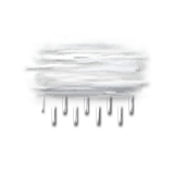
This afternoon in Plan d'eau de Cuchet, Overcast and misty, reduced visibility. Drizzle intensifying and turning to rain.
Temperatures will vary between 3 and 5°C.
The reliability of the situation is good.
This afternoon
5°Feels Like 4°
Gusts 15 km/hCalm
Overcast and misty. Limited visibility.
Drizzle becoming heavier and forming rain.
Risk of rain
100 %
UV index0Low
This evening
4°Feels Like 3°
Gusts 10 km/hCalm
Overcast and misty. Limited visibility.
Drizzle becoming heavier and forming rain.
Risk of rain
85 %
Night
3°Feels Like 2°
Gusts 10 km/hCalm
Overcast sky with a slight tendency to improvement.
Drizzle clearing gradually.
Risk of rain
60 %
Share
CLIMATE info
Rain
+40%
normal
More rain than normal
Water restriction: Warning
Temperature
-4°C
normal
Colder than normal
Normal temperature : 8°C
Average, today :
4°C
One year ago : 7°C