See all results
Your
favorites
édition
Become a V.I.P
Log in
Weather
Canada
Radar
Mountain
World
Weather
France
Auvergne-Rhône-Alpes
Ain
Souclin
Col de Fay
WEATHER COL DE FAY
Souclin (01150) - Ain - France
Sat
15
-
-
Sun
16
-
-
Mon
17
-
-
Tue
18
-
-
Wed
19
-
-
Thu
20
-
-
Fri
21
-
-
Sat
22
-
-
Sun
23
-
-
Mon
24
-
-
Tue
25
-
-
Wed
26
-
-
Thu
27
-
-
Fri
28
-
-
Sat
29
-
-
+
Day
Time / Hour
Compare
Today's Forecast
Forecast produced by
Alexis VANDEVOORDE
Updated at
07h30
- Next update at
12h45
(local time)
In Short
Follow the weather
live
Hour by hour
Weather comparator
Infos Climat
Expert’s summary
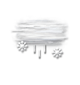
Today in Col de Fay, rain and snow will affect the region.
Temperatures will vary between -1 and 3°C.
The reliability of the situation is very good.
9:00 to 12:00
0°
Feels Like 0°
Gusts
10 km/h
Calm
Overcast and misty. Limited visibility.
Drizzle mixed with sleet.
Risk of snow
100 %
UV index
0
Low
This afternoon
3°
Feels Like 2°
Gusts
15 km/h
Calm
Overcast and misty. Limited visibility.
Light sleet.
Risk of rain
100 %
UV index
1
Low
This evening
1°
Feels Like 1°
Gusts
10 km/h
Calm
Overcast and misty. Limited visibility.
Light rain followed by snow.
Risk of rain
95 %
Night
1°
Feels Like 0°
Gusts
10 km/h
Calm
Overcast and misty. Limited visibility.
Snow showers clearing later.
Risk of snow
80 %
Tomorrow's weather
Weekend weather
Share
Link copied
CLIMATE info
Rain
+20%
normal
More rain than normal
Water restriction:
Warning
Temperature
-5°C
normal
Colder than normal
Normal temperature : 6°C
Average, today : 1°C
One year ago : 8°C
Drought
0
/5
No drought
Fire-risk indicator
Risk Low
Ephemeris
Saturday 15 march
Day
+3 min
Waning
gibbous Moon
Sunrise
06h50
Sunset
18h44
Clement Hofbauer
Next few days
Tomorrow,
Sunday 16
-
|
-
-
-
km/h
Monday 17
-
|
-
-
-
km/h
Tuesday 18
-
|
-
-
-
km/h
Near
Col de Fay
Souclin
Saint-Sorlin-en-Bugey
Torcieu
Cleyzieu
Vertrieu
Lagnieu
Vaux-en-Bugey
Sault-Brénaz
Bettant
Conand
Saint-Rambert-en-Bugey
Villebois
Weather France
Lyon
Marseille
Nice
Paris
Toulouse
Melun
Mende
Metz
Mont-de-Marsan
Montauban
Montélimar
Montpellier