See all results
Your
favorites
édition
Become a V.I.P
Log in
Weather
Canada
Radar
Mountain
World
Weather
United States
Sandia Peak (ski resort)
WEATHER SKI RESORT SANDIA PEAK
Albuquerque - United States
Sat
15
-
-
Sun
16
-
-
Mon
17
-
-
Tue
18
-
-
Wed
19
-
-
Thu
20
-
-
Fri
21
-
-
Sat
22
-
-
Sun
23
-
-
Mon
24
-
-
Tue
25
-
-
Wed
26
-
-
Thu
27
-
-
Fri
28
-
-
Sat
29
-
-
+
Day
Time / Hour
Compare
Today's Forecast
Forecast produced by
Régis CRÊPET
Updated at
05h30
- Next update at
11h45
(local time)
In Short
N.C.
Ski resort info
Follow the weather
live
Hour by hour
Weather comparator
Expert’s summary
Today in Sandia Peak, warning: increasingly sustained gusts.
Temperatures will vary between -4 and 4°C.
The reliability of the situation is very good.
This morning
-4°
Feels Like -7°
due to the wind
Gusts
40 km/h
W 25 km/h
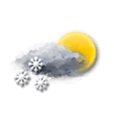
Very cloudy sky with short sunny periods.
Snow showers clearing later.
Risk of snow
35 %
UV index
2
Low
Freezing level 0°
1550 m
Snow-rain limit
1250 m
Fresh snow
0 cm
This afternoon
4°
Feels Like 4°
Gusts
65 km/h
NW 35 km/h
Very cloudy sky becoming more unsettled.
No precipitation.
No risk of rain
UV index
4
Moderate
Freezing level 0°
2050 m
Snow-rain limit
1750 m
Fresh snow
0 cm
This evening
1°
Feels Like -4°
due to the wind
Gusts
65 km/h
NW 30 km/h
Good weather with few clouds.
No precipitation.
No risk of rain
Freezing level 0°
2200 m
Snow-rain limit
1900 m
Fresh snow
0 cm
Night
-2°
Feels Like -6°
due to the wind
Gusts
45 km/h
W 25 km/h
CLEAR SKY.
No precipitation.
No risk of rain
Freezing level 0°
2000 m
Snow-rain limit
1700 m
Fresh snow
0 cm
Tomorrow's weather
Weekend weather
Share
Link copied
Station Info
open
Sandia Peak
Avalanche Risk
N.C.
Snow
N.C.
at the top (3163m)
N.C.
down (2645m)
Snowfall
2 days ago : 10.2 cm
1 month ago : 5.1 cm
1 month ago : 2.5 cm
Track Info
Lifts
-/4
Snow Parks
-/1
Nordic ski
N.C.
Back skiing
N.C.
Tracks
with
Ephemeris
Saturday 15 march
Day
+2 min
Waning
gibbous Moon
Sunrise
07h15
Sunset
19h13
Clement Hofbauer
Next few days
Tomorrow,
Sunday 16
-
|
-
-
-
km/h
Monday 17
-
|
-
-
-
km/h
Tuesday 18
-
|
-
-
-
km/h
Near
Sandia Peak
Albuquerque
Eldorado Heights
Corrales
Alameda
Chelwood Park
Vista Encantada
Bernalillo
Mesa Village
Sandia Vista
La Cuesta
Los Ranchos de Albuquerque
Buena Ventura
Weather United States
Los Angeles
Washington
San Francisco
New York
Chicago
Minneapolis
Seattle
Anchorage
Austin
Baltimore
Birmingham
Cleveland