Today in Shawnee Peak, warning: strong gusts.
Temperatures will vary between -11 and -8°C, it will be very cold in the morning.
The reliability of the situation is very good.
Tonight
-5°Feels Like -9°due to the wind
Gusts 50 km/hW 25 km/h
Clear periods.
Warning: conditions favourable to black ice.
No risk of rain
Freezing level 0°
0 m
Snow-rain limit
0 m
Fresh snow
0 cm
This morning
-10°Feels Like -14°due to the wind
Gusts 50 km/hW 25 km/h
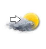
Unsettled weather becoming very cloudy.
Warning: conditions favourable to black ice.
No risk of rain
UV index1Low
Freezing level 0°
0 m
Snow-rain limit
0 m
Fresh snow
0 cm
This afternoon
-9°Feels Like -10°
Gusts 55 km/hW 25 km/h
Scattered clouds, but also several good sunny periods.
Warning: conditions favourable to black ice.
No risk of rain
UV index1Low
Freezing level 0°
0 m
Snow-rain limit
0 m
Fresh snow
0 cm
This evening
-12°Feels Like -14°due to the wind
Gusts 45 km/hW 20 km/h
Clear periods and passing clouds, sometimes heavy.
Warning: conditions favourable to black ice.
No risk of rain
Freezing level 0°
0 m
Snow-rain limit
0 m
Fresh snow
0 cm
Night
-12°Feels Like -14°due to the wind
Gusts 30 km/hSW 10 km/h
Unsettled weather becoming clear.
Warning: conditions favourable to black ice.
No risk of rain
Freezing level 0°
0 m
Snow-rain limit
0 m
Fresh snow
0 cm
Share
Station Info
open
Shawnee Peak
Avalanche Risk
N.C.
Snow
45 cm
at the top
(579m)
30 cm
down
(183m)
Snowfall
1 day ago : 2.54 cm 3 days ago : 25.4 cm 4 days ago : 25.4 cm